
Product
Scan, analyse, evaluate and document in one go.
Birdsview Concrete combines Ground Penetrating Radar, LiDAR and precise point-cloud registration into a single workflow. Locate rebar, post-tension, conduits and voids with millimetre accuracy, in context.
- Live GPR and LiDAR tracking
- Millimetre positioning
- Results on site
Three components, one system
Birdsview combines ground penetrating radar, LiDAR and cameras in one unit for non-destructive concrete inspection.
Scan complete. Explore the result in 3D
Vertical Rebars11/11 rebars · 0-600 mm depth
Average (11/11 rebars)
11.9mm
0-600 mm depth
Average (11/11 rebars)
96.9mm
0-600 mm depth
Average (11/11 rebars)
123.2mm
0-600 mm depth
Horizontal Rebars6/6 rebars · 0-600 mm depth
Average (6/6 rebars)
13.2mm
0-600 mm depth
Average (6/6 rebars)
100.7mm
0-600 mm depth
Average (6/6 rebars)
228.1mm
0-600 mm depth
Drag to rotate · Ctrl + scroll to zoom
These are real results from the Birdsview analysis service, not a mock-up. A 60 × 60 cm area of concrete was scanned with a ground-penetrating radar (GPR) in 28 line scans, and the service detected each rebar and estimated its diameter, cover and spacing. Filter by cover to isolate a rebar layer, hover a row of figures to highlight those rebars, and drag the 3D view to rotate it.
Full 3D model
Step inside a full structure in 3D
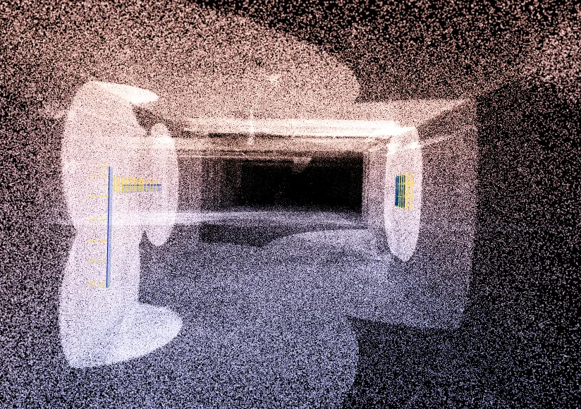
A real Birdsview project: the LiDAR scan of a concrete corridor, with the rebar from three radar scans placed exactly where they were found.
- LiDAR point cloud
- 3 real GPR scans
- Guided tour
Birdsview Concrete
One scanner. One platform. One product.
Birdsview Concrete is the handheld scanner and the Ostrich platform combined. The scanner captures the data on site, Ostrich turns it into rebar results.
Hardware
The scanner
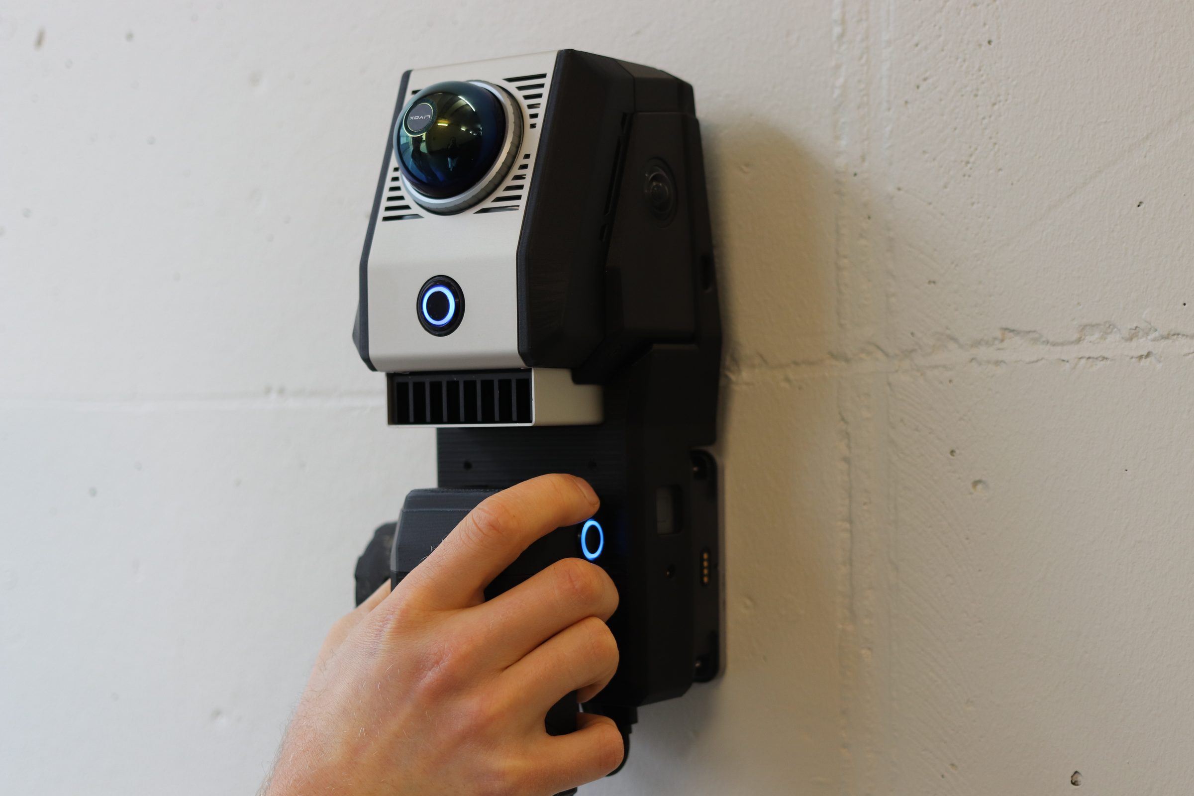
The Birdsview 3D Tracker and a Proceq GPR clamped together as one handheld unit. Every radar trace is positioned in a millimetre-accurate point cloud as you scan.
- GPR and LiDAR-based positioning in one sweep
- Scan freehand, no grid or external markers needed
- Cordless and site ready
Software
Ostrich
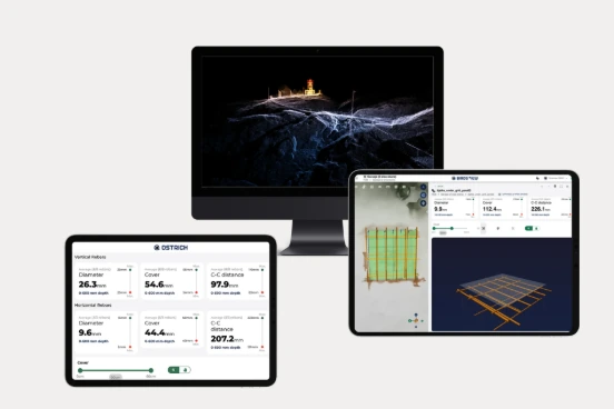
The Birdsview platform. Follow the scan live on the iPad in the field, then get the analysed results in Ostrich, ready to share with the project team.
- Live view of the scanned area on the iPad
- Automatic rebar detection: position, diameter, cover and spacing, delivered as a full 3D model
- Reports and exports, shared with field crews and office teams on the same dataset
- Export formats: gLTF and PLY, ready for the tools your project already uses
- Role-based access and project-level permissions
An Apple iPad is required to run Ostrich in the field. Full technical data under Specifications.
Technical data
Specifications
Tracker
Real-time tracking and positioning. Modular, compatible with add-on modules and adaptable to other equipment. Open API for custom integrations.
| Property | Value | Imperial equivalent |
|---|---|---|
| Viewing range | 40 m / 360° | 131 ft |
| Accuracy | ± 30 mm | ± 1.2 in |
| Dimensions | 9 × 9 × 9 cm | 3.5 × 3.5 × 3.5 in |
| Weight | 1 kg | 2.2 lb |
Algorithms
Position, rebar diameter estimate, cover and spacing for every detected rebar, delivered as a full 3D model. Fully automated. No calibration or manual interpretation required.
| Property | Value | Imperial equivalent |
|---|---|---|
| Diameter accuracy | ± 1–3 mm | ± 0.04–0.12 in |
| Cover accuracy | ± 1–2 mm | ± 0.04–0.08 in |
| Centre-to-centre | ± 1–4 mm | ± 0.04–0.16 in |
GPR: Proceq GP8800
Built for tight and hard-to-reach areas. Cordless and lightweight, easy to handle on vertical and overhead surfaces such as walls, beams and confined spaces.
| Property | Value | Imperial equivalent |
|---|---|---|
| Penetration | ≤ 65 cm | ≤ 25.6 in |
| Frequency | 400–6000 MHz | — |
| Weight | 500 g | 1.1 lb |
Coming soon
GPR: Proceq GP8100
Built for covering large areas efficiently. Smooth wheels and a wide scan footprint sweep entire floors, decks and slabs in a single session.
| Property | Value | Imperial equivalent |
|---|---|---|
| Penetration | ≤ 80 cm | ≤ 31.5 in |
| Frequency | 400–4000 MHz | — |
| Weight | 3 kg | 6.6 lb |
Applications
What it is used for
Project planning and tender accuracy.
Retrofitting assessments.
Maintenance planning.
Cutting and coring safety.
How it works