
How it works

From a walk across the surface to a structural model, on site

We combine millimetre-accurate 3D tracking with ground penetrating radar, then turn the raw signals into rebar geometry you can act on straight away.

The process

Four steps.

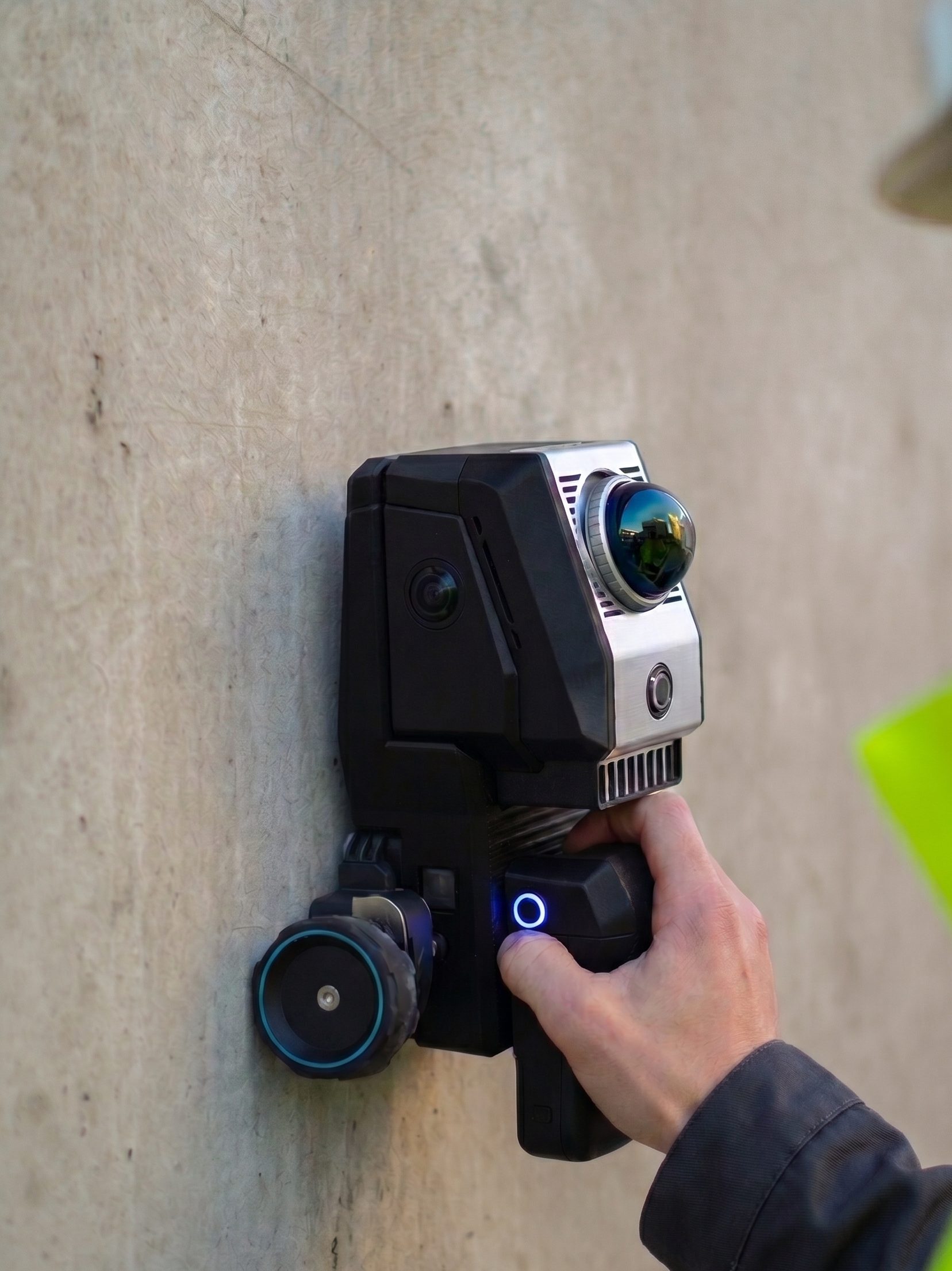
  1. Operator in hi-vis holding the Birdsview scanner against rough concrete

    GPR and lidar in a single handheld unit

    01

    Scan

    Roll the tracked unit across the surface. Ground penetrating radar, lidar and camera capture the structure together, at up to 500 m² per hour. The handheld scanner fuses ground-penetrating radar with LiDAR-based positioning. Every radar trace is registered to a millimetre-accurate point cloud as you sweep, so every reading knows where it came from.

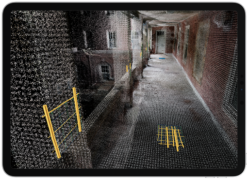
  2. Tablet showing a live point cloud with detected rebar

    Rebar detected and positioned while you scan

    02

    Analyse on the device

    The signals are fused and interpreted on board. No upload, no waiting for an office to process the raw data.

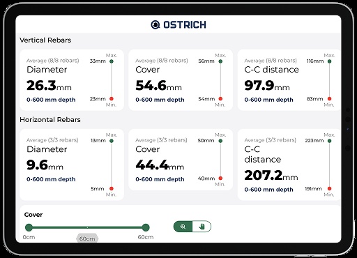
  3. Tablet showing diameter, cover and centre-to-centre distance measurements

    Diameter, cover and spacing, in the field

    03

    Result in under a minute

    Rebar position, cover and diameter appear as a 3D model with millimetre accuracy while you are still on site.

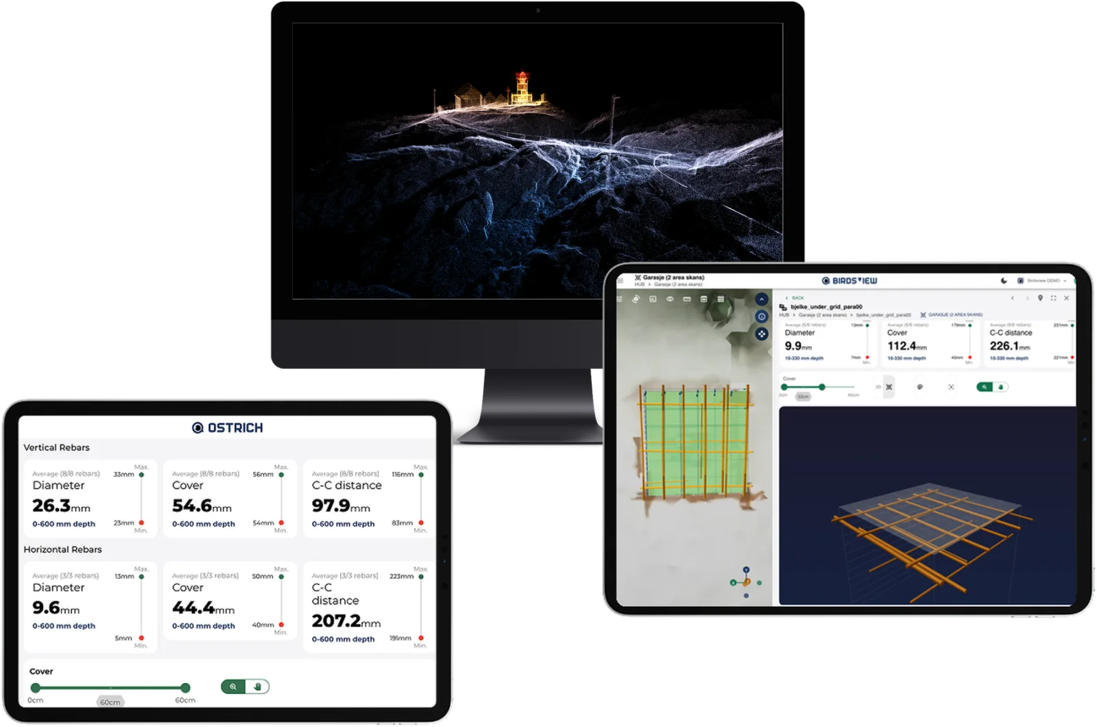
  4. Desktop, tablet and iPad showing a point cloud and rebar measurements in the Birdsview platform

    The full 3D model, in the field and back at the office

    04

    Everyone sees the same result

    Everything lands in one place in the cloud, and you decide who gets in. The structural engineer, the client and the contractor each get their own access and see exactly what you see. Nothing emailed around, no two versions in circulation. If someone needs the data inside their own software, it comes out in the formats their tools already read.

Under the hood

The science behind it

Three pieces of physics and maths make a non-destructive survey trustworthy.

Full Waveform Inversion

Instead of reading peaks in a radar trace, we model the entire waveform and solve for the material properties that could have produced it. The method comes from seismic imaging in oil and gas, where it is used to reconstruct kilometres of rock, we apply it to centimetres of concrete.

How GPR works

The radar emits short electromagnetic pulses into the concrete. Every change in material (a steel bar, a void, a moisture front) reflects part of that pulse back. Travel time and shape of the reflection tell us depth and size, and millimetre-accurate 3D tracking ties every single trace to an exact position on the structure.

AI classification

Models trained on field data from more than 70 projects separate rebar from noise, follow each bar through the volume and estimate diameter and cover automatically. The interpretation is consistent between operators, and the output is a structural model rather than an image someone has to read.